|
#1
April 5th, 2017, 06:17 PM
| |||
| |||
| MIDC Area In Aurangabad
Hello sir, is there any one can give me here Brief Industrial Profile of MIDC area in Aurangabad District? The Maharashtra Industrial Development Corporation began acquiring land and setting up industrial estates after 1960. Aurangabad District is located mainly in Godavari Basin and its some part towards North West of Tapi River Basin. This District’s general down level is towards South and East and North West part comes in Purna – Godavari river basin. The Aurangabad district’s North Longitude ( Degree) is 19 and 20 and East Longitude (Degree ) is 74 to 76. Land was acquired near Waluj Village on Aurangabad - Ahmednagar highway in the 1970s & 1980s. Total notified area is 1298 hectares (12.98 km2) Brief Industrial Profile of MIDC area in Aurangabad District 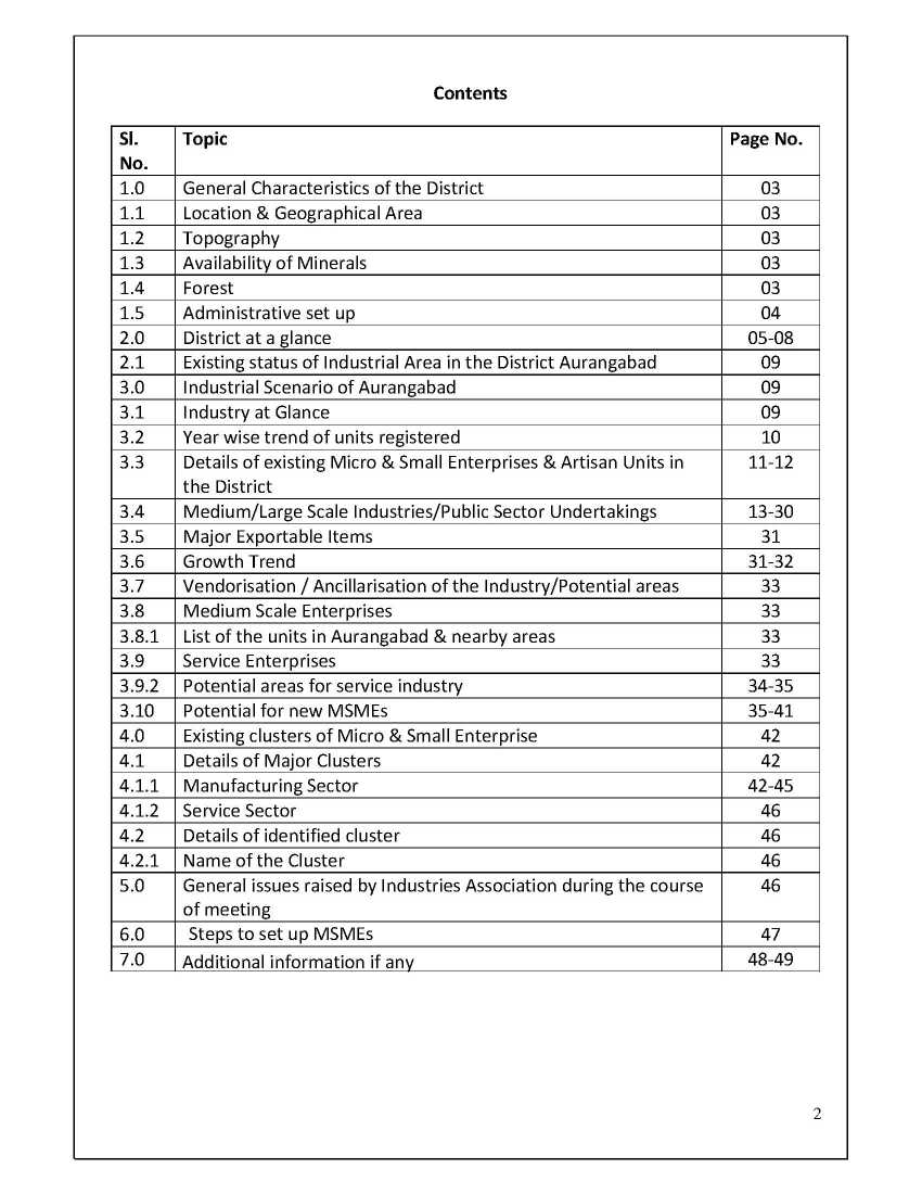 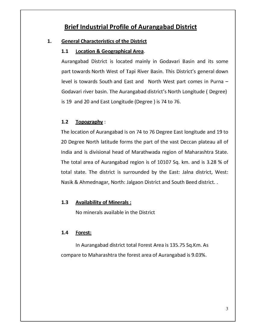   Here I’m attaching PDF of Brief Industrial Profile of MIDC area in Aurangabad District: Availability of Minerals: No minerals available in the District Forest: In Aurangabad district total Forest Area is 135.75 Sq.Km. As compare to Maharashtra the forest area of Aurangabad is 9.03%. Waluj Mahanagar, Aurangabad: Appointment of CIDCO as S.P.A. 07.10.91 Total Notified Area (Ha.) 8,670.00 Area in Phase I (Ha.) 1714.85 Area developed till date 160.00 Area yet to be developed (Ha.) 1554.00 Last edited by Neelurk; June 12th, 2020 at 11:49 AM. |